Autre image
Autre image
Autre image

49
Joan Blaeu
Geographiae Blauianae volumen tertium, quo Germania. 1662.
Estimation:
€ 18,000 / $ 21,240 Résultat:
€ 27,600 / $ 32,568 ( frais d'adjudication compris)
49
Joan Blaeu
Geographiae Blauianae volumen tertium, quo Germania. 1662.
Estimation:
€ 18,000 / $ 21,240 Résultat:
€ 27,600 / $ 32,568 ( frais d'adjudication compris)
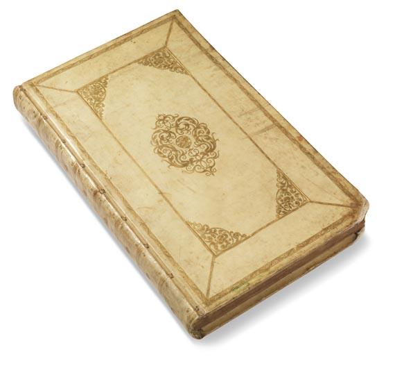
Blaeu, J., Geographiae Blauiana volumen tertium, quo Germania, quae est Europae liber octo. With 96 colored and gilt-heightened copper maps (95 double page, folding). Amsterdam, Blaeu 1662. Gilt-tooled orig. vellum with gilt edges. Imperial folio.
Koeman I, Bl 56. - Nice atlas of Germany, at the same time vol. III of the Atlas Major in Latin edition from 1662. This one a complete copy in a splendid coloring. - With complete map of Germany (actually Central Europe with Benelux, Alpine countries to Northern Italy, Poland, Czech Republic and Hungary) as well as partial maps of Germany, among the splendid map of Frankfurt and surroundings, which is particularly worthwhile mentioning for its broad armorial border, the map of Rugen with two armorial bars as well as the map of the duchies Schleswig and Holstein, framed by 18 small towns plans, made by J. Mejer from the 'Danckwerthsche Atlas', the plates were in possession of the publisher Blaeu. Also contains Brandenburg, Pomerania, Silesia, Moravia, Alsace, maps of the rivers Elbe, Rhine and Danube as well as of Austria with Tyrol, Carinthia, Styria and Salzburg. The nice and unusually broad-margined maps are mostly gilt-heightened and adorned with one or more additional decorative cartouches, often also with crests, compass roses, sailing ships and figures, less often with small inset plans of maps of places with a regional importance. - Condition: Slightly browned, stronger in second half and also foxed, 3 maps with tear in the folding, the map of Frankfurt torn in the folding half way and thoroughly padded, 1 map with small tear in the lower white margin, maps by J. with narrow margins (3 maps with folded right margin). Corners with defective spots. All in all remarkable and well-preserved copy of the atlas volume in a rare and splendid coloring.
Koeman I, Bl 56. - Nice atlas of Germany, at the same time vol. III of the Atlas Major in Latin edition from 1662. This one a complete copy in a splendid coloring. - With complete map of Germany (actually Central Europe with Benelux, Alpine countries to Northern Italy, Poland, Czech Republic and Hungary) as well as partial maps of Germany, among the splendid map of Frankfurt and surroundings, which is particularly worthwhile mentioning for its broad armorial border, the map of Rugen with two armorial bars as well as the map of the duchies Schleswig and Holstein, framed by 18 small towns plans, made by J. Mejer from the 'Danckwerthsche Atlas', the plates were in possession of the publisher Blaeu. Also contains Brandenburg, Pomerania, Silesia, Moravia, Alsace, maps of the rivers Elbe, Rhine and Danube as well as of Austria with Tyrol, Carinthia, Styria and Salzburg. The nice and unusually broad-margined maps are mostly gilt-heightened and adorned with one or more additional decorative cartouches, often also with crests, compass roses, sailing ships and figures, less often with small inset plans of maps of places with a regional importance. - Condition: Slightly browned, stronger in second half and also foxed, 3 maps with tear in the folding, the map of Frankfurt torn in the folding half way and thoroughly padded, 1 map with small tear in the lower white margin, maps by J. with narrow margins (3 maps with folded right margin). Corners with defective spots. All in all remarkable and well-preserved copy of the atlas volume in a rare and splendid coloring.


